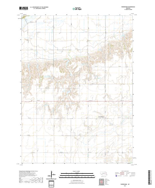
2021 Map of Swedehome
USGS Topo · Published 2021About this map
Swedehome serves as the focal point of this Polk County agricultural landscape, reflecting the Swedish heritage of the central Nebraska plains. The settlement pattern is defined by the rigid grid of county roads, including 30, 31, and 32, which segment the fertile terrain into large farmsteads. A critical spiritual and social center for the community is marked at Calvary Cem & Ch, where the church and cemetery stand together as a record of local families. The natural drainage of the area is carved by Clear Creek, which provides a breaks the geometric precision of the section lines. This 2021 survey documents the modern state of a region that remains deeply tied to its historical roots, maintaining its character as a quiet interior farming hub.
Find a feature on this map
12 named features on this map. Tap any name to fly to it.
Don’t see what you’re looking for? This feature index may not catch every label — zoom into the map to look around manually.
Map Details
Editions of this 2021 Swedehome Map
This is the sole edition of this map. No revisions or reprints were ever made.
Other maps of this area

1896 · Stromsburg
USGS Topo · 1:125,000

1955 · Fremont
USGS Topo · 1:250,000

1957 · Fremont
USGS Topo · 1:250,000

1958 · Fremont
USGS Topo · 1:250,000

1958 · Silver Creek SE
USGS Topo · 1:24,000

1958 · Silver Creek
USGS Topo · 1:24,000

1958 · Havens
USGS Topo · 1:24,000

1962 · Polk
USGS Topo · 1:24,000
1962 · Swedehome
USGS Topo · 1:24,000
1962 · Clarks
USGS Topo · 1:24,000