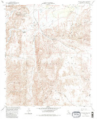
1959 Map of Sweeney Pass
USGS Topo · Published 1985About this map
Anza-Borrego Desert State Park dominates this 1959 topographic record of southeastern San Diego County, revealing a landscape defined by its historic transportation corridors and specialized desert environments. The Old Overland Stage Route skirts the Carrizo Badlands in the north, while the Vallecito Sweeney Pass Road descends through the center toward the San Diego and Arizona Eastern railroad tracks. These routes highlight the region's role as a gateway between the desert floor and the coastal ranges.
Find a feature on this map
39 named features on this map. Tap any name to fly to it.
Don’t see what you’re looking for? This feature index may not catch every label — zoom into the map to look around manually.
Map Details
Editions of this 1959 Sweeney Pass Map
4 editions found
Other maps of this area

1931 · Carrizo
USGS Topo · 1:125,000

1939 · Campo
USGS Topo · 1:62,500

1939 · Jacumba
USGS Topo · 1:62,500

1942 · Campo
USGS Topo · 1:62,500

1942 · Carrizo Mtn
USGS Topo · 1:62,500

1942 · Jacumba
USGS Topo · 1:62,500

1942 · Cuyapaipe
USGS Topo · 1:62,500

1950 · San Diego
USGS Topo · 1:250,000

1954 · San Diego
USGS Topo · 1:250,000

1955 · San Diego
USGS Topo · 1:250,000