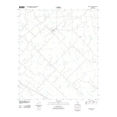
2010 Map of Sweet Home
USGS Topo · Published 2010About this map
Sweet Home serves as the primary settlement in this corner of Lavaca County, situated at the junction of FM 531 and US Hwy 77 Alt. The landscape is defined by a dense network of dendritic drainage systems, where small creeks and branches carve through the Texas coastal plains. To the north, North Fork Mustang Creek and South Fork Mustang Creek converge, while the southern reaches are dominated by Supplejack Creek and the Pilot Grove Branch. Local genealogy and community history are anchored by the Queen of Peace Cemetery near the town center and the more secluded Yellow Bank Cemetery to the east. This 2010 survey illustrates a rural environment where land use is dictated by the winding paths of waterways like Clarks Creek and Burncamp Creek, which influence the layout of the local county road system.
Find a feature on this map
56 named features on this map. Tap any name to fly to it.
Don’t see what you’re looking for? This feature index may not catch every label — zoom into the map to look around manually.
Map Details
Editions of this 2010 Sweet Home Map
This is the sole edition of this map. No revisions or reprints were ever made.
Other maps of this area

1953 · Seguin
USGS Topo · 1:250,000

1958 · Seguin
USGS Topo · 1:250,000

1962 · Edgar
USGS Topo · 1:24,000

1962 · Terryville
USGS Topo · 1:24,000

1962 · Hallettsville
USGS Topo · 1:24,000

1963 · Yoakum
USGS Topo · 1:24,000

1963 · Sweet Home
USGS Topo · 1:24,000

1964 · Ezzell
USGS Topo · 1:24,000

1965 · Wied
USGS Topo · 1:24,000

1965 · Hope
USGS Topo · 1:24,000