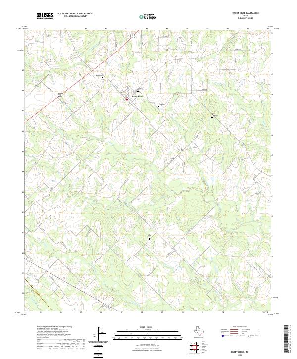
2022 Map of Sweet Home
USGS Topo · Published 2022About this map
Sweet Home is the primary settlement in this part of Lavaca County, situated amidst a landscape defined by meandering creeks and several small family and parish burial grounds. The community is clustered near the junction of FM 318 E and Alt US Highway 77, with Queen of Peace Cem and Sweet Home Cem providing local historical anchors. The terrain is deeply etched by a network of watercourses, including S Fork Mustang Cr to the north and the extensive Supplejack Cr system to the south.
Find a feature on this map
72 named features on this map. Tap any name to fly to it.
Don’t see what you’re looking for? This feature index may not catch every label — zoom into the map to look around manually.
Map Details
Editions of this 2022 Sweet Home Map
This is the sole edition of this map. No revisions or reprints were ever made.
Other maps of this area

1953 · Seguin
USGS Topo · 1:250,000

1958 · Seguin
USGS Topo · 1:250,000

1962 · Edgar
USGS Topo · 1:24,000

1962 · Terryville
USGS Topo · 1:24,000

1962 · Hallettsville
USGS Topo · 1:24,000

1963 · Yoakum
USGS Topo · 1:24,000

1963 · Sweet Home
USGS Topo · 1:24,000

1964 · Ezzell
USGS Topo · 1:24,000

1965 · Wied
USGS Topo · 1:24,000

1965 · Hope
USGS Topo · 1:24,000