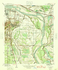
1945 Map of Sweet Home
USGS Topo · Published 1946About this map
The Arkansas River meanders through this mid-1940s landscape, shaping the industrial and agricultural character of the southern Little Rock vicinity. South of the city, the community of College Station and the Union Industrial Agriculture College anchor a landscape defined by significant transit and resource extraction, including several Strip Mine operations near Granite Mtn. This era shows a dense network of local landmarks, from Adams Airport on the river's edge to the St Louis Southwestern and Missouri Pacific railroads that facilitated the region's commerce.
Find a feature on this map
48 named features on this map. Tap any name to fly to it.
Don’t see what you’re looking for? This feature index may not catch every label — zoom into the map to look around manually.
Map Details
Editions of this 1945 Sweet Home Map
3 editions found
Other maps of this area

1891 · Little Rock
USGS Topo · 1:125,000

1893 · Little Rock
USGS Topo · 1:125,000

1935 · Mc Almont
USGS Topo · 1:24,000

1935 · Little Rock
USGS Topo · 1:24,000

1935 · Sweet Home
USGS Topo · 1:24,000

1935 · North Little Rock
USGS Topo · 1:24,000

1935 · Alexander
USGS Topo · 1:48,000

1939 · Keo
USGS Topo · 1:31,680

1940 · Woodson
USGS Topo · 1:31,680

1941 · Alexander
USGS Topo · 1:62,500