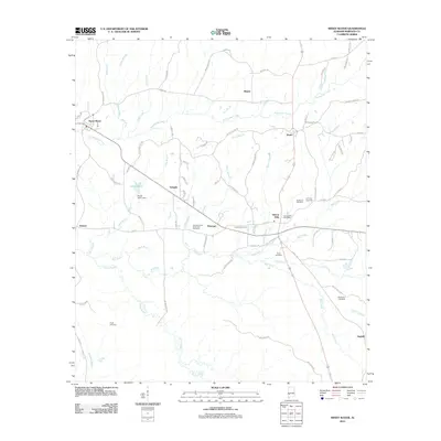
2011 Map of Sweet Water
USGS Topo · Published 2011About this map
Sweet Water serves as a primary hub in this Marengo County landscape, situated near the headwaters of Sweetwater Creek and the Sweet Water Dam. The region is defined by a dense network of smaller drainages including Shell Creek, Horse Creek, and Mill Creek, which have historically dictated the placement of rural settlements and transport routes.
Find a feature on this map
85 named features on this map. Tap any name to fly to it.
Don’t see what you’re looking for? This feature index may not catch every label — zoom into the map to look around manually.
Map Details
Editions of this 2011 Sweet Water Map
This is the sole edition of this map. No revisions or reprints were ever made.
Other maps of this area

1953 · Montgomery
USGS Topo · 1:250,000

1953 · Andalusia
USGS Topo · 1:250,000

1956 · Montgomery
USGS Topo · 1:250,000

1957 · Montgomery
USGS Topo · 1:250,000

1957 · Andalusia
USGS Topo · 1:250,000

1973 · Thomasville
USGS Topo · 1:24,000

1978 · Surginer
USGS Topo · 1:24,000

1978 · Sweet Water
USGS Topo · 1:24,000
1978 · Bashi
USGS Topo · 1:24,000
1978 · Nanafalia
USGS Topo · 1:24,000