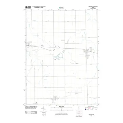
2010 Map of Sweetser
USGS Topo · Published 2010About this map
Swayzee and Sweetser anchor this agricultural landscape in Grant County, where the grid of modern county roads meets a complex network of historical drainage infrastructure. The terrain is defined by a dense system of man-made waterways designed to manage the fertile land, including Mathews Ditch, Sweetser Ditch, and Farley Ditch. These channels feed into natural watercourses such as Pipe Creek and Taylor Creek, which wind through the township boundaries.
Find a feature on this map
56 named features on this map. Tap any name to fly to it.
Don’t see what you’re looking for? This feature index may not catch every label — zoom into the map to look around manually.
Map Details
Editions of this 2010 Sweetser Map
This is the sole edition of this map. No revisions or reprints were ever made.
Other maps of this area

1953 · La Fontaine
USGS Topo · 1:24,000

1953 · Somerset
USGS Topo · 1:24,000

1953 · Peoria
USGS Topo · 1:24,000

1953 · Muncie
USGS Topo · 1:250,000

1956 · Muncie
USGS Topo · 1:250,000

1960 · Point Isabel
USGS Topo · 1:24,000

1960 · Fairmount
USGS Topo · 1:24,000

1960 · Greentown
USGS Topo · 1:24,000

1961 · Marion
USGS Topo · 1:24,000
1962 · Amboy
USGS Topo · 1:24,000