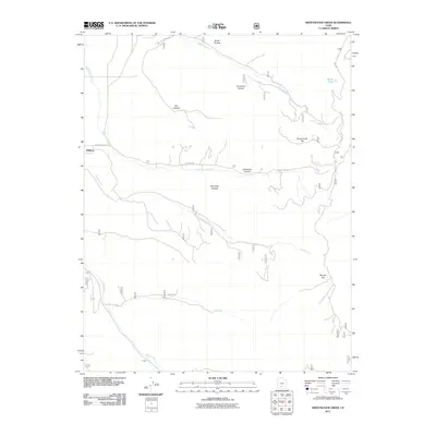
2011 Map of Sweetwater Creek
USGS Topo · Published 2011About this map
Widtsoe stands as a focal point in this high-plateau landscape, marking a site of historic settlement near the western edge of the quadrangle. The area is defined by a complex drainage network where Sweetwater Creek and South Creek flow eastward through dramatic terrain, including the steep descents of Escalante Canyon. The geography is characterized by prominent flat-topped elevations such as Horse Creek Top and Barney Top, which rise above a series of named depressions like Hurricane Hollow and Manning Hollow. Transport through this portion of Garfield County follows the established path of the Old Escalante Rd, which traverses the central portion of the map. Smaller water features like Horse Lake and several intermittent drainages, including Dry Creek and Clay Creek, suggest the arid but rugged nature of this interior Utah territory.
Find a feature on this map
15 named features on this map. Tap any name to fly to it.
Don’t see what you’re looking for? This feature index may not catch every label — zoom into the map to look around manually.
Map Details
Editions of this 2011 Sweetwater Creek Map
This is the sole edition of this map. No revisions or reprints were ever made.
Other maps of this area

1886 · Kanab
USGS Topo · 1:250,000

1886 · Escalante
USGS Topo · 1:250,000

1953 · Cedar City
USGS Topo · 1:250,000

1956 · Escalante
USGS Topo · 1:250,000

1958 · Cedar City
USGS Topo · 1:250,000

1960 · Escalante
USGS Topo · 1:250,000

1962 · Cedar City
USGS Topo · 1:250,000

1964 · Griffin Point
USGS Topo · 1:24,000

1964 · Barker Reservoir
USGS Topo · 1:24,000
1964 · Grass Lakes
USGS Topo · 1:24,000