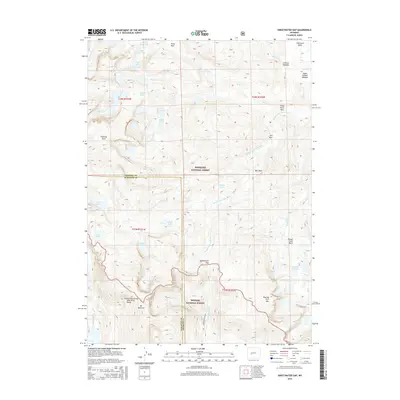
2015 Map of Sweetwater Gap
USGS Topo · Published 2015About this map
Continental Divide Wind River Range bisects this high-elevation landscape, marking the boundary between the Shoshone National Forest and Bridger National Forest. The map captures a complex alpine environment defined by granite peaks and glacial catchments, anchored by Mt Nystrom and the prominent Chimney Rock. The drainage patterns are clearly visible, with the Sweetwater River flowing south through the Sweetwater Gap, while the Middle Popo Agie River and its tributaries, such as Tayo Cr and Basco Cr, carve through the eastern slopes. This 2015 survey provides a detailed view of several high-country basins, including Stough Creek Basin and Shoshone Basin. Numerous alpine water bodies, such as Mountain Sheep Lake, Coon Lake, and the Stough Cr Lakes, dot the landscape, illustrating the concentration of glacial tarns common to this portion of the Fremont and Sublette County border.
Find a feature on this map
44 named features on this map. Tap any name to fly to it.
Don’t see what you’re looking for? This feature index may not catch every label — zoom into the map to look around manually.
Map Details
Editions of this 2015 Sweetwater Gap Map
This is the sole edition of this map. No revisions or reprints were ever made.
Other maps of this area

1937 · Moccasin Lake
USGS Topo · 1:48,000

1943 · Moccasin Lake
USGS Topo · 1:62,500

1953 · Sweetwater Gap
USGS Topo · 1:24,000

1953 · Cony Mountain
USGS Topo · 1:24,000

1953 · Mount Arter
USGS Topo · 1:24,000

1953 · Christina Lake
USGS Topo · 1:24,000

1955 · Lander
USGS Topo · 1:250,000

1958 · Lander
USGS Topo · 1:250,000

1961 · Lander
USGS Topo · 1:250,000

1969 · Jensen Meadows
USGS Topo · 1:24,000