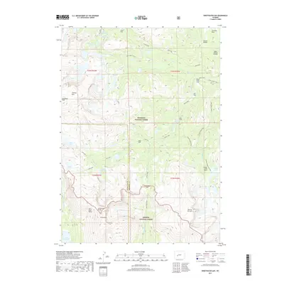
2017 Map of Sweetwater Gap
USGS Topo · Published 2017About this map
The Continental Divide bisects this high-elevation landscape, marking the hydrological split between the Sweetwater River and the Middle Popo Agie River. Within the Shoshone National Forest and Bridger National Forest, the terrain is defined by dramatic peaks such as Wind River Peak and Mt Nystrom, alongside the prominent Sweetwater Gap. This 2017 survey details a remote wilderness network of trails and alpine lakes, including the Stough Creek Trail and the Deep Creek Cutoff. The map illustrates a concentration of high-country water bodies like Tayo Lake, Ice Lakes, and Deep Cr Lakes, which sit below granite features like Chimney Rock and the massive Roaring Fork Mtn. This area serves as a critical junction for the Wind River Range, where the Sublette and Fremont county lines meet amidst meadows like Bills Park and Johnson Meadow.
Find a feature on this map
49 named features on this map. Tap any name to fly to it.
Don’t see what you’re looking for? This feature index may not catch every label — zoom into the map to look around manually.
Map Details
Editions of this 2017 Sweetwater Gap Map
This is the sole edition of this map. No revisions or reprints were ever made.
Other maps of this area

1937 · Moccasin Lake
USGS Topo · 1:48,000

1943 · Moccasin Lake
USGS Topo · 1:62,500

1953 · Sweetwater Gap
USGS Topo · 1:24,000

1953 · Cony Mountain
USGS Topo · 1:24,000

1953 · Mount Arter
USGS Topo · 1:24,000

1953 · Christina Lake
USGS Topo · 1:24,000

1955 · Lander
USGS Topo · 1:250,000

1958 · Lander
USGS Topo · 1:250,000

1961 · Lander
USGS Topo · 1:250,000

1969 · Jensen Meadows
USGS Topo · 1:24,000