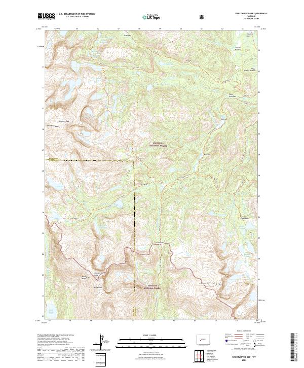
2021 Map of Sweetwater Gap
USGS Topo · Published 2021About this map
The Continental Divide carves through the high country of the Wind River Range, marking the boundary between the Shoshone National Forest and Bridger National Forest. This alpine landscape is defined by the headwaters of the Sweetwater River, which flows south from the Sweetwater Gap, and the Middle Popo Agie River to the north. The area is a labyrinth of glacial features, from the dramatic spire of Chimney Rock to the high basins holding Tayo Lake, Coon Lake, and the numerous Stough Cr Lakes. Traces of human activity are limited to a network of established wilderness paths like the Sweetwater Gap Trl and Tayo Lake Trl, which connect meadows such as Pinto Park and Tayo Park. Dominating the western skyline are the massive peaks of Wind River Peak and Mt Nystrom, standing as anchors of this undeveloped high-altitude terrain.
Find a feature on this map
59 named features on this map. Tap any name to fly to it.
Don’t see what you’re looking for? This feature index may not catch every label — zoom into the map to look around manually.
Map Details
Editions of this 2021 Sweetwater Gap Map
This is the sole edition of this map. No revisions or reprints were ever made.
Other maps of this area

1937 · Moccasin Lake
USGS Topo · 1:48,000

1943 · Moccasin Lake
USGS Topo · 1:62,500

1953 · Sweetwater Gap
USGS Topo · 1:24,000

1953 · Cony Mountain
USGS Topo · 1:24,000

1953 · Mount Arter
USGS Topo · 1:24,000

1953 · Christina Lake
USGS Topo · 1:24,000

1955 · Lander
USGS Topo · 1:250,000

1958 · Lander
USGS Topo · 1:250,000

1961 · Lander
USGS Topo · 1:250,000

1969 · Jensen Meadows
USGS Topo · 1:24,000