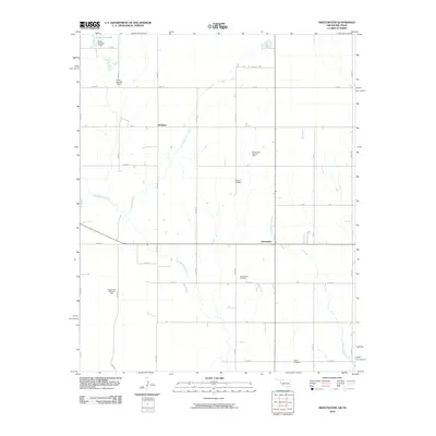
2010 Map of Sweetwater
USGS Topo · Published 2010About this map
Sweetwater sits at a geographic crossroads along the border of Oklahoma and Texas, where the local economy and landscape are shaped by energy extraction and agriculture. The presence of the Sweetwater NW Gas Field, Sweetwater West Gas Field, and Sweetwater Gas Field indicates the significance of natural gas production in this region during the early 21st century. The terrain is defined by a series of north-south and east-west rural roads that grid the landscape, providing access to remote homesteads and energy sites.
Find a feature on this map
35 named features on this map. Tap any name to fly to it.
Don’t see what you’re looking for? This feature index may not catch every label — zoom into the map to look around manually.
Map Details
Editions of this 2010 Sweetwater Map
This is the sole edition of this map. No revisions or reprints were ever made.
Other maps of this area

1954 · Amarillo
USGS Topo · 1:250,000

1955 · Clinton
USGS Topo · 1:250,000

1957 · Clinton
USGS Topo · 1:250,000

1958 · Amarillo
USGS Topo · 1:250,000

1960 · Sweetwater
USGS Topo · 1:62,500

1961 · Reydon
USGS Topo · 1:62,500

1962 · Kelton SE
USGS Topo · 1:24,000

1963 · Allison
USGS Topo · 1:24,000

1963 · Kelton
USGS Topo · 1:24,000
1982 · Pampa
USGS Topo · 1:100,000