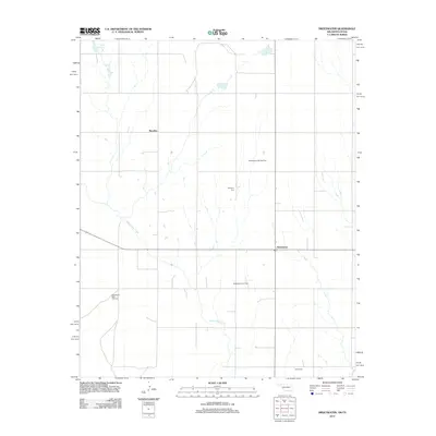
2012 Map of Sweetwater
USGS Topo · Published 2012About this map
The community of Sweetwater lies at the heart of this landscape along the border of Oklahoma and Texas, where the local economy is defined by a network of energy infrastructure and rural settlements. Energy extraction is a prominent feature of the terrain, with the Sweetwater NW Gas Field, Sweetwater West Gas Field, and the central Sweetwater Gas Field marking the subterranean resources of the region.
Find a feature on this map
9 named features on this map. Tap any name to fly to it.
Don’t see what you’re looking for? This feature index may not catch every label — zoom into the map to look around manually.
Map Details
Editions of this 2012 Sweetwater Map
This is the sole edition of this map. No revisions or reprints were ever made.
Other maps of this area

1954 · Amarillo
USGS Topo · 1:250,000

1955 · Clinton
USGS Topo · 1:250,000

1957 · Clinton
USGS Topo · 1:250,000

1958 · Amarillo
USGS Topo · 1:250,000

1960 · Sweetwater
USGS Topo · 1:62,500

1961 · Reydon
USGS Topo · 1:62,500

1962 · Kelton SE
USGS Topo · 1:24,000

1963 · Allison
USGS Topo · 1:24,000

1963 · Kelton
USGS Topo · 1:24,000
1982 · Pampa
USGS Topo · 1:100,000