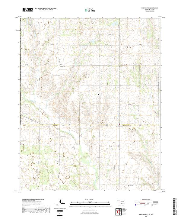
2022 Map of Sweetwater
USGS Topo · Published 2022About this map
The Oklahoma-Texas borderlands define this 2022 survey, centered on the community of Sweetwater at the crossing of ew110 RD and N 1720 RD. The landscape is primarily shaped by the drainage networks of Sweetwater Cr, W Buffalo Cr, and Freezeout Cr, which carve through the high plains of the Beckham and Roger Mills county line. Evidence of early settlement persists in the form of rural landmarks like Mulberry Cem and Salem Cem, while the small community of Meridian sits near the northern section of the map. The map captures a contemporary look at the section-line road grid that has dictated the region's agricultural layout since land runs and early settlement days, showing how these corridors continue to link remote homesteads and ranches in the modern era.
Find a feature on this map
30 named features on this map. Tap any name to fly to it.
Don’t see what you’re looking for? This feature index may not catch every label — zoom into the map to look around manually.
Map Details
Editions of this 2022 Sweetwater Map
This is the sole edition of this map. No revisions or reprints were ever made.
Other maps of this area

1954 · Amarillo
USGS Topo · 1:250,000

1955 · Clinton
USGS Topo · 1:250,000

1957 · Clinton
USGS Topo · 1:250,000

1958 · Amarillo
USGS Topo · 1:250,000

1960 · Sweetwater
USGS Topo · 1:62,500

1961 · Reydon
USGS Topo · 1:62,500

1962 · Kelton SE
USGS Topo · 1:24,000

1963 · Allison
USGS Topo · 1:24,000

1963 · Kelton
USGS Topo · 1:24,000
1982 · Pampa
USGS Topo · 1:100,000