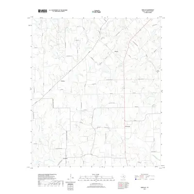
2019 Map of Swiss Alp
USGS Topo · Published 2019About this map
Freyburg and Swiss Alp anchor this agricultural landscape in Fayette County, where the upper reaches of the E Navidad River and W Navidad River begin their descent. The map reveals a pattern of dispersed rural settlements, including O'Quinn and Hostyn, connected by a network of farm-to-market roads and family-named routes like Abbotts Grove School Rd.
Find a feature on this map
71 named features on this map. Tap any name to fly to it.
Don’t see what you’re looking for? This feature index may not catch every label — zoom into the map to look around manually.
Map Details
Editions of this 2019 Swiss Alp Map
This is the sole edition of this map. No revisions or reprints were ever made.
Other maps of this area

1901 · Flatonia
USGS Topo · 1:125,000

1919 · Schulenburg
USGS Topo · 1:62,500

1953 · Seguin
USGS Topo · 1:250,000

1956 · La Grange
USGS Topo · 1:62,500

1957 · La Grange East
USGS Topo · 1:24,000

1957 · Ammannsville
USGS Topo · 1:24,000

1958 · La Grange West
USGS Topo · 1:24,000
1958 · West Point
USGS Topo · 1:24,000

1958 · Seguin
USGS Topo · 1:250,000

1965 · Muldoon
USGS Topo · 1:24,000