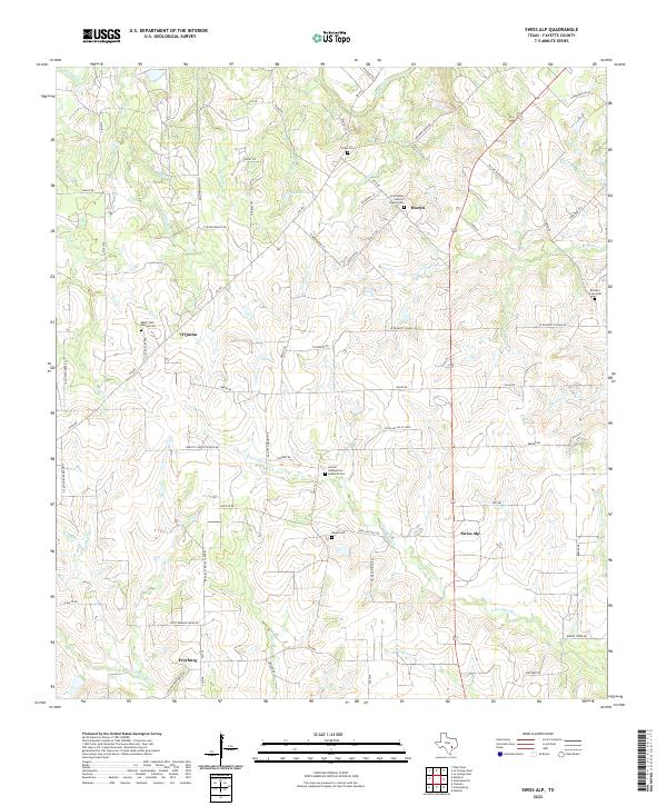
2022 Map of Swiss Alp
USGS Topo · Published 2022About this map
Swiss Alp and the surrounding Fayette County countryside are defined by the convergence of several major tributaries, most notably the E Navidad River and W Navidad River. This agricultural landscape is dotted with long-established settlements such as Hostyn, O'Quinn, and Freyburg, each anchored by historical institutions. Genealogists will find a high density of burial grounds including Holy Rosary Catholic Church Cem and the United Evangelical Lutheran Cem, reflecting the early Central Texas immigrant communities that shaped this region. The map reveals an intricate network of local farm-to-market roads and family-named routes like Ohnhreiser Kaase Rd and Falke-Heinrich Rd, which traverse a terrain drained by numerous branches like Iron-Ore Br and Buckners Cr. The presence of small reservoirs like Lake El-Leo further illustrates the rural land use patterns of this Texas prairie and creek environment.
Find a feature on this map
78 named features on this map. Tap any name to fly to it.
Don’t see what you’re looking for? This feature index may not catch every label — zoom into the map to look around manually.
Map Details
Editions of this 2022 Swiss Alp Map
This is the sole edition of this map. No revisions or reprints were ever made.
Other maps of this area

1901 · Flatonia
USGS Topo · 1:125,000

1919 · Schulenburg
USGS Topo · 1:62,500

1953 · Seguin
USGS Topo · 1:250,000

1956 · La Grange
USGS Topo · 1:62,500

1957 · La Grange East
USGS Topo · 1:24,000

1957 · Ammannsville
USGS Topo · 1:24,000

1958 · La Grange West
USGS Topo · 1:24,000
1958 · West Point
USGS Topo · 1:24,000

1958 · Seguin
USGS Topo · 1:250,000

1965 · Muldoon
USGS Topo · 1:24,000