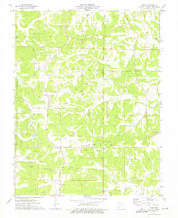
1973 Map of Swiss
USGS Topo · Published 1975About this map
Swiss and Stony Hill anchor this rural landscape in Gasconade County during the early 1970s. The region is defined by a dense network of family-named cemeteries, including Boesch Cem, Sanders Cem, and Roth Cem, which provide significant value for genealogists tracing local lineage. The topography is deeply carved by numerous watercourses such as Little Berger Creek, Big Berger Creek, and Clifty Creek, with Boggs Lake providing a notable still-water feature.
Find a feature on this map
21 named features on this map. Tap any name to fly to it.
Don’t see what you’re looking for? This feature index may not catch every label — zoom into the map to look around manually.
Map Details
Editions of this 1973 Swiss Map
This is the sole edition of this map. No revisions or reprints were ever made.
Other maps of this area

1890 · Hermann
USGS Topo · 1:125,000

1890 · Fulton
USGS Topo · 1:125,000

1903 · Sullivan
USGS Topo · 1:125,000

1934 · Bland
USGS Topo · 1:62,500

1935 · Gerald
USGS Topo · 1:48,000

1935 · Morrison
USGS Topo · 1:48,000

1936 · Hermann
USGS Topo · 1:48,000

1937 · Bland
USGS Topo · 1:62,500

1941 · Gerald
USGS Topo · 1:62,500

1942 · Morrison
USGS Topo · 1:62,500