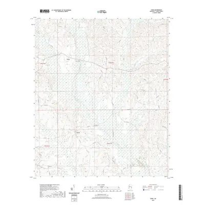
2020 Map of Sykes
USGS Topo · Published 2020About this map
Linton and Sykes anchor this portion of Clarke County, where the landscape is defined by an intricate network of waterways draining toward the larger Buckatunna Creek. The map documents a rural Mississippi environment shaped by timber and agriculture, crisscrossed by a grid of county roads such as Linton Rd and Brushy Creek Rd. Settled life is marked by the presence of Elim Cem and Pine Grove Cem, providing valuable touchpoints for family history researchers tracking local lineages. Notable crossings like Davis Bridge over Long Cr and Slay Bridge illustrate the importance of these specific points for local navigation. The terrain is deeply textured with small drainages including Indian Cr, Rattlesnake Cr, and Tallabogue Cr, reflecting a traditional Southern creek-bottom geography where roads often follow the subtle ridges between these winding watercourses.
Find a feature on this map
49 named features on this map. Tap any name to fly to it.
Don’t see what you’re looking for? This feature index may not catch every label — zoom into the map to look around manually.
Map Details
Editions of this 2020 Sykes Map
This is the sole edition of this map. No revisions or reprints were ever made.
Other maps of this area

1953 · Hattiesburg
USGS Topo · 1:250,000

1953 · Meridian
USGS Topo · 1:250,000

1957 · Meridian
USGS Topo · 1:250,000

1957 · Quitman
USGS Topo · 1:62,500

1958 · Hattiesburg
USGS Topo · 1:250,000

1964 · Carmichael
USGS Topo · 1:24,000

1964 · De Soto
USGS Topo · 1:24,000

1965 · Meridian
USGS Topo · 1:250,000

1974 · Melvin
USGS Topo · 1:24,000

1974 · Yantley
USGS Topo · 1:24,000