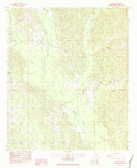
1983 Map of Sykes
USGS Topo · Published 1983About this map
Buckatunna Creek and Tallabogue Creek define the drainage patterns of this rural landscape in Clarke County. The map documents small, dispersed settlements like Sykes and Linton, which are connected by a network of unimproved roads and light-duty trails typical of Mississippi's interior during the early 1980s. Local social and community centers are clearly marked by a high density of country churches, including James Chapel, Elim Ch, and Mt Gillard Ch.
Find a feature on this map
21 named features on this map. Tap any name to fly to it.
Don’t see what you’re looking for? This feature index may not catch every label — zoom into the map to look around manually.
Map Details
Editions of this 1983 Sykes Map
This is the sole edition of this map. No revisions or reprints were ever made.
Other maps of this area

1953 · Hattiesburg
USGS Topo · 1:250,000

1953 · Meridian
USGS Topo · 1:250,000

1957 · Meridian
USGS Topo · 1:250,000

1957 · Quitman
USGS Topo · 1:62,500

1958 · Hattiesburg
USGS Topo · 1:250,000

1964 · Carmichael
USGS Topo · 1:24,000

1964 · De Soto
USGS Topo · 1:24,000

1965 · Meridian
USGS Topo · 1:250,000

1974 · Melvin
USGS Topo · 1:24,000

1974 · Yantley
USGS Topo · 1:24,000