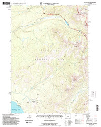
1991 Map of Sylvan Lake
USGS Topo · Published 1996About this map
Yellowstone National Park reveals its geothermal and high-elevation character on this 1991 survey, centered on the dramatic ascent to Sylvan Pass. The landscape is defined by hydrothermal activity, most notably at the Brimstone Basin and various other Thermal Areas that dot the terrain. To the south, the map captures a portion of the Southeast Arm Yellowstone Lake, where the Thorofare Trail begins its trek into the interior wilderness.
Find a feature on this map
30 named features on this map. Tap any name to fly to it.
Don’t see what you’re looking for? This feature index may not catch every label — zoom into the map to look around manually.
Map Details
Editions of this 1991 Sylvan Lake Map
2 editions found
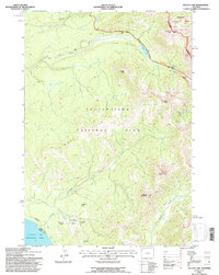
Other maps of this area

1885 · Lake
USGS Topo · 1:125,000

1886 · Canyon
USGS Topo · 1:125,000

1895 · Canyon
USGS Topo · 1:125,000

1895 · Lake
USGS Topo · 1:125,000

1896 · Lake
USGS Topo · 1:125,000

1896 · Canyon
USGS Topo · 1:125,000

1901 · Canyon
USGS Topo · 1:125,000

1901 · Lake
USGS Topo · 1:125,000

1906 · Lake
USGS Topo · 1:125,000

1907 · Canyon
USGS Topo · 1:125,000