
1953 Map of Sylvan
USGS Topo · Published 1954About this map
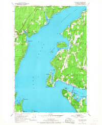
Carr Inlet and Hale Passage define the intricate shoreline of the Key Peninsula and Fox Island during the early 1950s. This survey reveals a landscape of summer camps and community infrastructure, including Camp Seymour and Camp Colman, alongside the Minter Community Center. A notable engineering detail of the era is the Fox Island Bridge Under Construction, a project that would soon replace the traditional water-based access to the island. Small settlements and coastal developments like Glencove, Rosedale, and Sylvan are documented with their early road networks, such as the Kitsap Minter Road. Along the northern reaches, the State Biological Sta and Fish Hatchery stands at the head of Henderson Bay, highlighting the region's historical reliance on maritime and natural resources.
Find a feature on this map
46 named features on this map. Tap any name to fly to it.
Don’t see what you’re looking for? This feature index may not catch every label — zoom into the map to look around manually.
Map Details
Editions of this 1953 Sylvan Map
5 editions found
Other maps of this area

1937 · Olympia
USGS Topo · 1:62,500

1938 · Allyn
USGS Topo · 1:62,500

1940 · Anderson Island
USGS Topo · 1:62,500

1942 · Gig Harbor
USGS Topo · 1:62,500

1943 · Gig Harbor
USGS Topo · 1:62,500

1948 · Anderson Island
USGS Topo · 1:62,500

1948 · Anderson Island
USGS Topo · 1:24,000

1948 · Steilacoom
USGS Topo · 1:24,000

1949 · Olympia
USGS Topo · 1:62,500

1953 · Burley
USGS Topo · 1:24,000