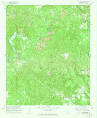
1971 Map of Sylvan Springs
USGS Topo · Published 1973About this map
Locust Fork dominates the western half of this 1971 survey, serving as a vital industrial artery where several railroads converge to serve the region's extractive economy. The industrial landscape is defined by numerous Strip Mine operations and the facilities at Port Birmingham, while the Birmingham Southern, Louisville and Nashville, and St Louis San Francisco railroads trace the winding terrain to connect these coal-rich areas.
Find a feature on this map
39 named features on this map. Tap any name to fly to it.
Don’t see what you’re looking for? This feature index may not catch every label — zoom into the map to look around manually.
Map Details
Editions of this 1971 Sylvan Springs Map
3 editions found
Other maps of this area

1889 · Birmingham
USGS Topo · 1:125,000

1890 · Bessemer
USGS Topo · 1:125,000

1892 · Birmingham
USGS Topo · 1:125,000

1892 · Bessemer
USGS Topo · 1:125,000

1893 · Jasper
USGS Topo · 1:125,000

1895 · Birmingham
USGS Topo · 1:125,000

1899 · Brookwood
USGS Topo · 1:125,000

1904 · Birmingham Coal District
USGS Topo · 1:62,500

1905 · Bessemer Iron District
USGS Topo · 1:62,500

1906 · Birmingham Special
USGS Topo · 1:62,500