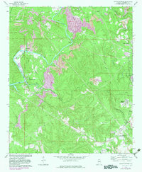
1971 Map of Sylvan Springs
USGS Topo · Published 1983About this map
Locust Fork winds through a landscape defined by its industrial foundations and mining settlements northwest of Birmingham. This 1971 record (with 1982 edits) reveals the dense network of strip mines and oil wells that fueled the local economy, particularly around Praco and Labuco. The map captures the specialized transport infrastructure of the era, from the Birmingham Southern railroad serving the river terminal at Port Birmingham to the Woodruff Bridge and Atwood Ferry Bridge spanning the water. For researchers, the inclusion of small community landmarks like Salter Cem and Atwood Cem provides essential grounding for genealogy in these worker-focused settlements. The transition from industrial corridors to residential pockets like Sylvan Springs and Booker Heights reflects the mid-century development patterns of Jefferson County's western hills.
Find a feature on this map
34 named features on this map. Tap any name to fly to it.
Don’t see what you’re looking for? This feature index may not catch every label — zoom into the map to look around manually.
Map Details
Editions of this 1971 Sylvan Springs Map
3 editions found
Other maps of this area

1889 · Birmingham
USGS Topo · 1:125,000

1890 · Bessemer
USGS Topo · 1:125,000

1892 · Birmingham
USGS Topo · 1:125,000

1892 · Bessemer
USGS Topo · 1:125,000

1893 · Jasper
USGS Topo · 1:125,000

1895 · Birmingham
USGS Topo · 1:125,000

1899 · Brookwood
USGS Topo · 1:125,000

1904 · Birmingham Coal District
USGS Topo · 1:62,500

1905 · Bessemer Iron District
USGS Topo · 1:62,500

1906 · Birmingham Special
USGS Topo · 1:62,500