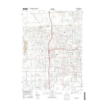
2013 Map of Sylvania
USGS Topo · Published 2013About this map
The Michigan-Ohio state line bisects this landscape, separating Monroe and Lucas counties in a region defined by the transition from the city of Toledo to the established suburban and rural pockets of Sylvania and Lambertville. This area is a dense concentration of community institutions and memorials, anchored by the expansive grounds of Toledo Memorial Park and the academic campus of Lourdes Coll. The natural hydrology of the region is traced through the winding paths of Tenmile Creek and the Ottawa River, which flow through a mix of developed residential grids and preserved green spaces like the R A Stranahan Senior Arboretum and Camp Miakonda. Local history is preserved in numerous burial grounds, from the Whiteford Union Cemetery to the Resurrection Cemetery, while industrial and utility sites like the Sylvania Water Works and the Toledo Suburban Airport highlight the area's essential infrastructure.
Find a feature on this map
53 named features on this map. Tap any name to fly to it.
Don’t see what you’re looking for? This feature index may not catch every label — zoom into the map to look around manually.
Map Details
Editions of this 2013 Sylvania Map
This is the sole edition of this map. No revisions or reprints were ever made.
Other maps of this area

1900 · Toledo
USGS Topo · 1:62,500

1911 · Swanton
USGS Topo · 1:62,500

1912 · Dundee
USGS Topo · 1:62,500

1914 · Swanton
USGS Topo · 1:62,500

1926 · Dundee
USGS Topo · 1:62,500

1934 · Rossford
USGS Topo · 1:24,000

1935 · Whitehouse
USGS Topo · 1:24,000

1935 · Maumee
USGS Topo · 1:24,000

1935 · Berkey
USGS Topo · 1:24,000

1936 · Samaria
USGS Topo · 1:31,680