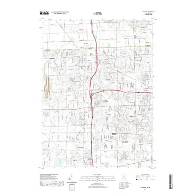
2019 Map of Sylvania
USGS Topo · Published 2019About this map
Sylvania and the western suburbs of Toledo occupy this landscape along the Michigan and Ohio state line. The map shows a transition from the established residential streets of Ottawa Hills and Reynolds Corners to the open land around Toledo Suburban Airport and the quarries near Silica. Several major drainage features, including Tenmile Cr and the Ottawa River, weave through the developed corridors. Notable institutional presence includes the campus of Lourdes University and several large memorial grounds such as Toledo Memorial Park Cem and Resurrection Cem. The density of the suburban grid is most evident along W Central Ave and W Alexis Rd, while the southern reaches near Holland show a mix of parks like Haven Park and named drainage channels such as Drennan Ditch and Kallager Ditch.
Find a feature on this map
60 named features on this map. Tap any name to fly to it.
Don’t see what you’re looking for? This feature index may not catch every label — zoom into the map to look around manually.
Map Details
Editions of this 2019 Sylvania Map
This is the sole edition of this map. No revisions or reprints were ever made.
Other maps of this area

1900 · Toledo
USGS Topo · 1:62,500

1911 · Swanton
USGS Topo · 1:62,500

1912 · Dundee
USGS Topo · 1:62,500

1914 · Swanton
USGS Topo · 1:62,500

1926 · Dundee
USGS Topo · 1:62,500

1934 · Rossford
USGS Topo · 1:24,000

1935 · Whitehouse
USGS Topo · 1:24,000

1935 · Maumee
USGS Topo · 1:24,000

1935 · Berkey
USGS Topo · 1:24,000

1936 · Samaria
USGS Topo · 1:31,680