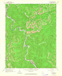
1965 Map of Sylvester
USGS Topo · Published 1966About this map
The Big Coal River carves a winding path through this portion of Sherman District, anchoring a corridor of rail-served coal settlements during the mid-1960s. Following the riverbank and the Chesapeake and Ohio railroad, towns such as Seth, Fosterville, Orgas, and Sylvester reveal the concentrated industrial and residential development of the era. Extensive Strip Mines mark the high ridges above Joes Creek and White Oak Creek, illustrating the intense extraction activity that defined the regional economy. Beyond the mines, local life is documented through several hilltop burial grounds, including Pettry Cem and Mt Hope Cem, and social markers like the Drive-in Theater near Sylvester. This survey captures a moment when the transition from deep valley mining to ridge-top strip mining was visibly reshaping the landscape of Boone and Kanawha counties.
Find a feature on this map
57 named features on this map. Tap any name to fly to it.
Don’t see what you’re looking for? This feature index may not catch every label — zoom into the map to look around manually.
Map Details
Editions of this 1965 Sylvester Map
2 editions found
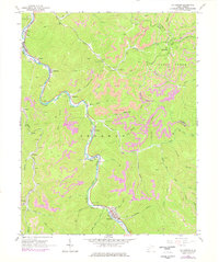
Other maps of this area

1891 · Oceana
USGS Topo · 1:125,000

1891 · Raleigh
USGS Topo · 1:125,000

1893 · Oceana
USGS Topo · 1:125,000

1897 · Kanawha Falls
USGS Topo · 1:125,000

1897 · Raleigh
USGS Topo · 1:125,000

1898 · Oceana
USGS Topo · 1:125,000

1899 · Charleston
USGS Topo · 1:125,000

1900 · Kanawha Falls
USGS Topo · 1:125,000

1901 · Kanawha Falls
USGS Topo · 1:125,000

1902 · Raleigh
USGS Topo · 1:125,000