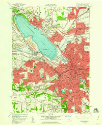
1958 Map of Syracuse West
USGS Topo · Published 1960About this map
Onondaga Lake serves as the central anchor for this mid-century view of the developing Syracuse metropolitan area. The landscape is a study in industrial and civic transition, where the historic Erie Canal and New York Central corridors meet modern infrastructure like the New York State Thruway. To the west, the village of Solvay is defined by extensive Waste Beds and industrial activity along Ninemile Creek, while the State Fairgrounds occupies a prominent stretch of the lake’s southwestern shore.
Find a feature on this map
123 named features on this map. Tap any name to fly to it.
Don’t see what you’re looking for? This feature index may not catch every label — zoom into the map to look around manually.
Map Details
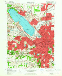
Editions of this 1958 Syracuse West Map
2 editions found
Other maps of this area

1895 · Syracuse
USGS Topo · 1:62,500

1898 · Syracuse
USGS Topo · 1:62,500

1899 · Skaneateles
USGS Topo · 1:62,500

1900 · Baldwinsville
USGS Topo · 1:62,500

1900 · Tully
USGS Topo · 1:62,500

1902 · Skaneateles
USGS Topo · 1:62,500

1938 · Syracuse East
USGS Topo · 1:24,000

1939 · Syracuse West
USGS Topo · 1:24,000

1940 · Brewerton
USGS Topo · 1:24,000

1940 · Cicero
USGS Topo · 1:24,000