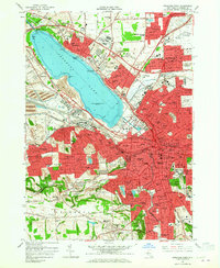
1958 Map of Syracuse West
USGS Topo · Published 1965About this map
Syracuse and its western suburbs appear here during a period of significant post-war expansion, as indicated by the sprawling residential developments in Westvale and Mattydale. The map captures the industrial and transportation infrastructure that shaped the region, from the New York State Thruway cutting across the northern reaches to the extensive rail lines of the New York Central and Delaware Lackawanna and Western. Along the shores of Onondaga Lake, the historic Fort Ste Marie De Gandentaha stands near the State Fairgrounds, reflecting a landscape where colonial history and modern recreation coexist. Institutional landmarks are prominent, including the Syracuse University campus and a dense network of parish schools like St Brigids Sch. Higher elevations to the south around Onondaga Hill and Loomis Hill provide a geographic contrast to the lake basin, dotted with local landmarks like the Loomis Hill Cem and Bellevue Country Club.
Find a feature on this map
101 named features on this map. Tap any name to fly to it.
Don’t see what you’re looking for? This feature index may not catch every label — zoom into the map to look around manually.
Map Details
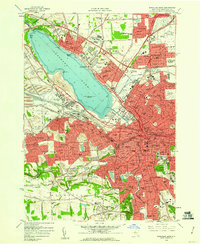
Editions of this 1958 Syracuse West Map
2 editions found
Other maps of this area

1895 · Syracuse
USGS Topo · 1:62,500

1898 · Syracuse
USGS Topo · 1:62,500

1899 · Skaneateles
USGS Topo · 1:62,500

1900 · Baldwinsville
USGS Topo · 1:62,500

1900 · Tully
USGS Topo · 1:62,500

1902 · Skaneateles
USGS Topo · 1:62,500

1938 · Syracuse East
USGS Topo · 1:24,000

1939 · Syracuse West
USGS Topo · 1:24,000

1940 · Brewerton
USGS Topo · 1:24,000

1940 · Cicero
USGS Topo · 1:24,000