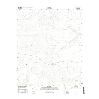
2016 Map of T-O Creek
USGS Topo · Published 2016About this map
The Salt Fork Brazos River and its confluence with the White River dominate the northern drainage of this Kent County landscape. The terrain is characterized by a series of named draws and hollows that carve through the high plains, illustrating the gradual erosion typical of the West Texas caprock region. Distinctive landmarks like Shin Hollow and Joe Smith Draw suggest a history of early ranching and land use, where local families left their mark on the geography. In the southeast corner, Schoolhouse Hollow points to a time when rural education centers were centralized within these sprawling drainage systems. Modern connectivity is maintained through the intersection of FM 1081 and several county roads, which follow the natural contours between T-O Cr and Salt Cr.
Find a feature on this map
18 named features on this map. Tap any name to fly to it.
Don’t see what you’re looking for? This feature index may not catch every label — zoom into the map to look around manually.
Map Details
Editions of this 2016 T-O Creek Map
This is the sole edition of this map. No revisions or reprints were ever made.
Other maps of this area
1954 · Lubbock
USGS Topo · 1:250,000
1962 · Twomile Creek
USGS Topo · 1:24,000
1968 · Spur SW
USGS Topo · 1:24,000
1968 · White Camp
USGS Topo · 1:24,000
1969 · Cottonwood Creek
USGS Topo · 1:24,000
1969 · Justiceburg SE
USGS Topo · 1:24,000
1969 · Cooper Mountain
USGS Topo · 1:24,000
1969 · Clairemont West
USGS Topo · 1:24,000
1969 · T-O Creek
USGS Topo · 1:24,000
1969 · Polar
USGS Topo · 1:24,000