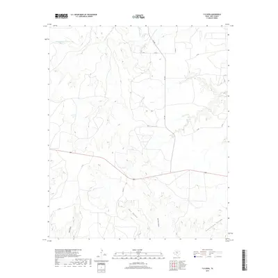
2019 Map of T-O Creek
USGS Topo · Published 2019About this map
Salt Fork Brazos River and its various tributaries define the landscape of Kent County in this contemporary survey. The confluence of the White River and the Salt Fork dominates the northern sector, while the namesake T-O Cr meanders through the central terrain. This area is characterized by complex erosional patterns, evident in the numerous named landforms such as Shin Hollow, Joe Smith Draw, and Schoolhouse Hollow. Human activity is primarily represented by a network of rural roads and highways, including Fm 1081 and Route 380, connecting the scattered ranchlands. The presence of features like Home Draw suggests the locations of historical homesteads or seasonal camps in an environment where water sources like Salt Cr dictate the layout of travel routes and local connectors.
Find a feature on this map
19 named features on this map. Tap any name to fly to it.
Don’t see what you’re looking for? This feature index may not catch every label — zoom into the map to look around manually.
Map Details
Editions of this 2019 T-O Creek Map
This is the sole edition of this map. No revisions or reprints were ever made.
Other maps of this area
1954 · Lubbock
USGS Topo · 1:250,000
1962 · Twomile Creek
USGS Topo · 1:24,000
1968 · Spur SW
USGS Topo · 1:24,000
1968 · White Camp
USGS Topo · 1:24,000
1969 · Cottonwood Creek
USGS Topo · 1:24,000
1969 · Justiceburg SE
USGS Topo · 1:24,000
1969 · Cooper Mountain
USGS Topo · 1:24,000
1969 · Clairemont West
USGS Topo · 1:24,000
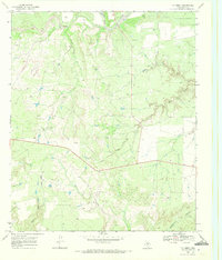
1969 · T-O Creek
USGS Topo · 1:24,000
1969 · Polar
USGS Topo · 1:24,000