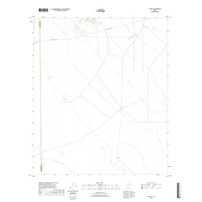
2019 Map of T P Well
USGS Topo · Published 2019About this map
T P Well sits within a high-desert landscape defined by the convergence of ranching infrastructure and mid-century utility corridors. This West Texas terrain is marked by a network of water collection points essential for desert survival and livestock, including New Tank, Willow Tanks, and Hideaway Tank, alongside the larger catchment of Cottonwood Lake. The map illustrates a sparse but vital logistical network, where the natural drainage of Borrego Draw is intersected by industrial markers like the El Paso Jal Pipeline Rd. The boundary between El Paso County and Hudspeth County cuts across the western edge of the sheet, highlighting the administrative division in this open country. The presence of San Felipe and other local roads suggests a landscape organized around isolated outposts and utility maintenance in an arid environment where water sources like T P Well serve as the primary landmarks.
Find a feature on this map
9 named features on this map. Tap any name to fly to it.
Don’t see what you’re looking for? This feature index may not catch every label — zoom into the map to look around manually.
Map Details
Editions of this 2019 T P Well Map
This is the sole edition of this map. No revisions or reprints were ever made.
Other maps of this area

1894 · Fort Hancock
USGS Topo · 1:125,000

1896 · El Paso
USGS Topo · 1:125,000

1896 · Rio Grande
USGS Topo · 1:125,000

1903 · Cerro Alto
USGS Topo · 1:125,000

1908 · El Paso
USGS Topo · 1:125,000

1941 · Clint
USGS Topo · 1:62,500

1941 · Tornillo
USGS Topo · 1:62,500

1942 · Borrego
USGS Topo · 1:62,500

1943 · Fort Hancock
USGS Topo · 1:62,500
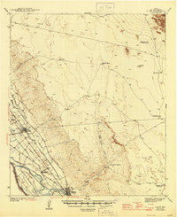
1945 · Clint
USGS Topo · 1:62,500