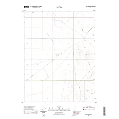
2020 Map of Table Mountain
USGS Topo · Published 2020About this map
Dugway Valley defines the western expanse of this high-desert terrain, where the arid landscape is marked by the distinct geologic formations of the White Marl Bluff and the prominent Table Mountain. The map detail traces the course of the Old River Bed as it cuts across the northern flats, a relic of ancient hydrological patterns. In the southeastern portion, the Slow Elk Hills and Slow Elk Wash illustrate the complex drainage systems of this portion of Tooele County. Human presence is represented primarily through infrastructure adapted to the dry environment, including the N Table Mountain Reservoir and E Dugway Reservoir, connected by a network of rural routes such as the Simpson Springs-Callao Rd and Flint Springs Rd.
Find a feature on this map
12 named features on this map. Tap any name to fly to it.
Don’t see what you’re looking for? This feature index may not catch every label — zoom into the map to look around manually.
Map Details
Editions of this 2020 Table Mountain Map
This is the sole edition of this map. No revisions or reprints were ever made.
Other maps of this area

1885 · Sevier Desert
USGS Topo · 1:250,000

1885 · Tooele Valley
USGS Topo · 1:250,000

1908 · Fish Springs
USGS Topo · 1:250,000

1910 · Fish Springs
USGS Topo · 1:250,000

1953 · Dugway Range NE
USGS Topo · 1:24,000

1953 · Dugway Pass
USGS Topo · 1:24,000

1953 · Dugway Range
USGS Topo · 1:62,500

1953 · Tooele
USGS Topo · 1:250,000

1953 · Delta
USGS Topo · 1:250,000

1954 · Dugway Proving Ground SE
USGS Topo · 1:24,000