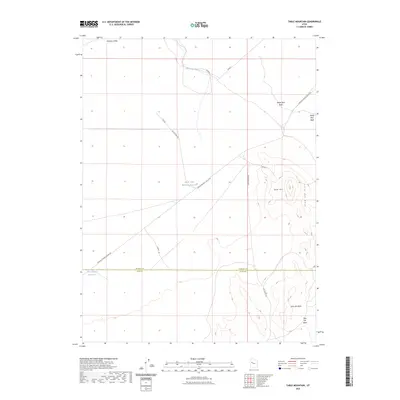
2023 Map of Table Mountain
USGS Topo · Published 2023About this map
Dugway Valley and the prehistoric drainage of the Old River Bed define this arid landscape on the border of Tooele and Juab counties. The terrain is dominated by the prominent uplift of Table Mtn and the neighboring Slow Elk Hills, which rise sharply from the basin floor. This modern survey reflects a region primarily characterized by its geological formations and sparse water resources, such as the North Table Mountain Reservoir. Access through this desert environment is maintained by established tracks like the Simpson Springs-Callao Rd and Flint Springs Rd, which connect the remote foothills to the larger basin. The presence of White Marl Bluff indicates the lacustrine history of the area, marking former shorelines in a territory where drainage features like the Slow Elk Wash only flow during significant weather events.
Find a feature on this map
17 named features on this map. Tap any name to fly to it.
Don’t see what you’re looking for? This feature index may not catch every label — zoom into the map to look around manually.
Map Details
Editions of this 2023 Table Mountain Map
This is the sole edition of this map. No revisions or reprints were ever made.
Other maps of this area

1885 · Sevier Desert
USGS Topo · 1:250,000

1885 · Tooele Valley
USGS Topo · 1:250,000

1908 · Fish Springs
USGS Topo · 1:250,000

1910 · Fish Springs
USGS Topo · 1:250,000

1953 · Dugway Range NE
USGS Topo · 1:24,000

1953 · Dugway Pass
USGS Topo · 1:24,000

1953 · Dugway Range
USGS Topo · 1:62,500

1953 · Tooele
USGS Topo · 1:250,000

1953 · Delta
USGS Topo · 1:250,000

1954 · Dugway Proving Ground SE
USGS Topo · 1:24,000