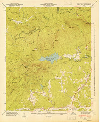
1947 Map of Table Rock
USGS Topo · Published 1947About this map
Table Rock and The Stool dominate this 1947 landscape, standing as massive granite sentinels above the newly established Table Rock State Park. Below these peaks, the Table Rock Reservoir fills the valley of the South Saluda River, reflecting a period of significant water resource development in the region. The map preserves a detailed record of rural social infrastructure, including the Saluda Hill Ch, Soapstone Ch, and several local schools like New Town Sch and Pleasant Grove Sch. These landmarks, along with family sites such as the Cassell Cems, offer a clear picture of the community before mid-century shifts. In the northern reaches, the high ridges of the Blue Ridge rise toward Caesars Head, where the Caesars Head Lookout Tower monitored the expansive Sumter National Forest.
Find a feature on this map
60 named features on this map. Tap any name to fly to it.
Don’t see what you’re looking for? This feature index may not catch every label — zoom into the map to look around manually.
Map Details
Editions of this 1947 Table Rock Map
2 editions found
Other maps of this area

1888 · Pickens
USGS Topo · 1:125,000

1894 · Pickens
USGS Topo · 1:125,000

1905 · Pisgah
USGS Topo · 1:125,000

1906 · Pisgah
USGS Topo · 1:125,000

1935 · Brevard
USGS Topo · 1:24,000

1935 · Eastatoe Gap
USGS Topo · 1:24,000

1935 · Standingstone Mtn.
USGS Topo · 1:24,000

1935 · Rosman
USGS Topo · 1:24,000

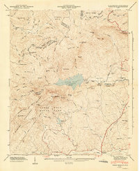
1935 · Table Rock
USGS Topo · 1:24,000
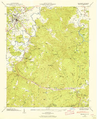
1945 · Brevard
USGS Topo · 1:24,000