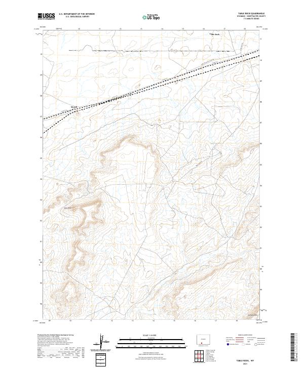
2021 Map of Table Rock
USGS Topo · Published 2021About this map
Monell sits along the northern edge of this high-desert landscape in Sweetwater County, where industrial infrastructure meets the vast horizons of the Wyoming basin. Modern energy development is evident through the presence of the Table Rock Gas Plant Rd, reflecting the region's long-standing reliance on natural resource extraction. The terrain is defined by dramatic elevation changes, most notably at the namesake Table Rock formation and the prominent Delaney Rim to the south.
Find a feature on this map
11 named features on this map. Tap any name to fly to it.
Don’t see what you’re looking for? This feature index may not catch every label — zoom into the map to look around manually.
Map Details
Editions of this 2021 Table Rock Map
This is the sole edition of this map. No revisions or reprints were ever made.
Other maps of this area

1954 · Rock Springs
USGS Topo · 1:250,000

1958 · Rock Springs
USGS Topo · 1:250,000

1962 · Rock Springs
USGS Topo · 1:250,000

1968 · Bitter Creek
USGS Topo · 1:24,000
1968 · Antelope Flats
USGS Topo · 1:24,000

1968 · Bitter Creek NE
USGS Topo · 1:24,000

1970 · Table Rock
USGS Topo · 1:24,000

1970 · J O Dugway
USGS Topo · 1:24,000

1970 · Fort La Clede NE
USGS Topo · 1:24,000

1970 · Tipton
USGS Topo · 1:24,000