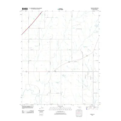
2012 Map of Tabler
USGS Topo · Published 2012About this map
Tabler serves as the central hub for this portion of Grady County, situated at the intersection of several section-line roads and a highway corridor. The landscape is defined by the complex drainage network of Bitter Creek and its many tributaries, including West Bitter Creek, East Bitter Creek, and Brushy Creek. This 2012 survey illustrates an extensive water management system featuring numerous numbered reservoirs such as Bitter Creek Site 21 Reservoir and Bitter Creek Site 20 Reservoir, which dictate the local topography and agricultural layout. In the southern reaches, the Washita River creates a meandering natural boundary, while the Good Life Ranch Airport in the northeast highlights the intersection of rural land use and specialized transportation infrastructure. The map preserves a detailed look at local road systems, from named thoroughfares like Maple Road and Elm Road to more formal county designations.
Find a feature on this map
42 named features on this map. Tap any name to fly to it.
Don’t see what you’re looking for? This feature index may not catch every label — zoom into the map to look around manually.
Map Details
Editions of this 2012 Tabler Map
This is the sole edition of this map. No revisions or reprints were ever made.
Other maps of this area

1902 · Rush Springs
USGS Topo · 1:125,000

1904 · Chickasha
USGS Topo · 1:125,000

1949 · Rush Springs
USGS Topo · 1:62,500

1950 · Rush Springs
USGS Topo · 1:62,500

1954 · Oklahoma City
USGS Topo · 1:250,000

1957 · Ardmore
USGS Topo · 1:250,000

1957 · Oklahoma City
USGS Topo · 1:250,000

1963 · Ardmore
USGS Topo · 1:250,000

1963 · Oklahoma City
USGS Topo · 1:250,000
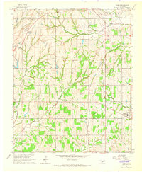
1965 · Dibble
USGS Topo · 1:24,000