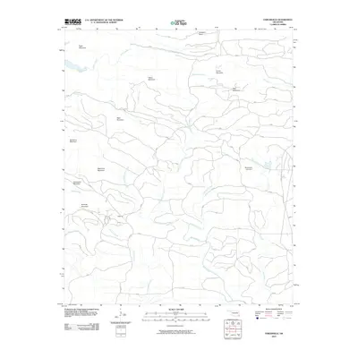
2010 Map of Tablerville
USGS Topo · Published 2010About this map
Tablerville anchors this Oklahoma landscape, situated at the confluence of several prominent drainage systems including Liksuklo Creek and Biggam Creek. This part of McCurtain County is defined by a dense network of ridges and watercourses, where the terrain is punctuated by significant elevations such as Eagle Mountain in the northwest and Big Nancy Mountain further south. The Mountain Fork river flows through the northern reaches, while the eastern portion is dominated by the long southward trek of Pero Creek toward the Henderson Lake Dam. The map reveals a transition between the high summits of the Ouachita region, including Welch Mountain and Hochatown Mountain, and the winding forest roads and trails like the Union Valley Trl that navigate these complex landforms. This 2010 survey illustrates the remote character of the area, showing how local landmarks like Gobblers Knob and Sage Mountain break up the high-relief topography.
Find a feature on this map
26 named features on this map. Tap any name to fly to it.
Don’t see what you’re looking for? This feature index may not catch every label — zoom into the map to look around manually.
Map Details
Editions of this 2010 Tablerville Map
This is the sole edition of this map. No revisions or reprints were ever made.
Other maps of this area

1902 · Lukfata
USGS Topo · 1:125,000

1913 · De Queen
USGS Topo · 1:125,000

1950 · Mcalester
USGS Topo · 1:250,000

1959 · Cove
USGS Topo · 1:62,500

1959 · Broken Bow
USGS Topo · 1:62,500

1960 · Smithville
USGS Topo · 1:62,500

1962 · McAlester
USGS Topo · 1:250,000

1965 · McAlester
USGS Topo · 1:250,000
1965 · Chapel Hill
USGS Topo · 1:24,000
1966 · De Queen NW
USGS Topo · 1:24,000