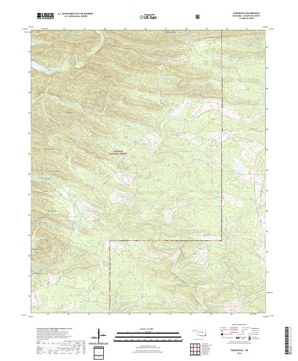
2022 Map of Tablerville
USGS Topo · Published 2022About this map
The Ouachita National Forest dominates this landscape in McCurtain County, Oklahoma, defined by a complex network of ridgelines and watercourses. High points like Locust Mtn, Welch Mtn, and Big Nancy Mtn overlook a series of creeks and branches that drain the mountain terrain. Historically, this area represents the densely wooded interior of the Choctaw Nation, where the rugged topography shaped early transit and settlement patterns. Notable water features such as Otter Creek and Middle Rock Cr carve through the landscape, while established paths like the Rock Creek Trl and Union Valley Trl provide modern access through the forest. The map detail highlights the intersection of public land management and the enduring geography of the Kiamichi Mountains, showing how landform names like Gobblers Knob and Fivemile Hollow reflect local vernacular and land use history.
Find a feature on this map
40 named features on this map. Tap any name to fly to it.
Don’t see what you’re looking for? This feature index may not catch every label — zoom into the map to look around manually.
Map Details
Editions of this 2022 Tablerville Map
This is the sole edition of this map. No revisions or reprints were ever made.
Other maps of this area

1902 · Lukfata
USGS Topo · 1:125,000

1913 · De Queen
USGS Topo · 1:125,000

1950 · Mcalester
USGS Topo · 1:250,000

1959 · Cove
USGS Topo · 1:62,500

1959 · Broken Bow
USGS Topo · 1:62,500

1960 · Smithville
USGS Topo · 1:62,500

1962 · McAlester
USGS Topo · 1:250,000

1965 · McAlester
USGS Topo · 1:250,000
1965 · Chapel Hill
USGS Topo · 1:24,000
1966 · De Queen NW
USGS Topo · 1:24,000