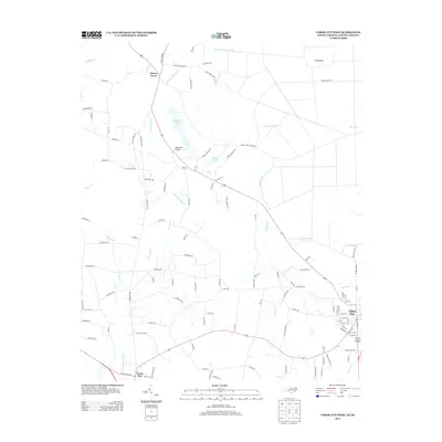
2013 Map of Tabor City West
USGS Topo · Published 2013About this map
Tabor City sits at the eastern edge of this landscape, where the street grid of the town center meets the agricultural and marshy lowlands of the North and South Carolina border. The terrain is defined by a complex network of slow-moving water, including Gapway Swamp and Iron Springs Swamp, which drain the timber and farm tracts that dominate the area. The western portions of the sheet are marked by smaller communities such as Cherry Grove and Green Sea, connected by rural routes like Fair Bluff HWY and Powell RD.
Find a feature on this map
130 named features on this map. Tap any name to fly to it.
Don’t see what you’re looking for? This feature index may not catch every label — zoom into the map to look around manually.
Map Details
Editions of this 2013 Tabor City West Map
This is the sole edition of this map. No revisions or reprints were ever made.
Other maps of this area

1943 · Pages Mill
USGS Topo · 1:62,500

1948 · Bayboro
USGS Topo · 1:24,000

1949 · Bayboro
USGS Topo · 1:24,000

1949 · Duford
USGS Topo · 1:24,000

1953 · Chadbourn
USGS Topo · 1:62,500

1953 · Florence
USGS Topo · 1:250,000

1954 · Florence
USGS Topo · 1:250,000
1962 · Loris
USGS Topo · 1:24,000

1962 · Fair Bluff
USGS Topo · 1:24,000
1962 · Goretown
USGS Topo · 1:24,000