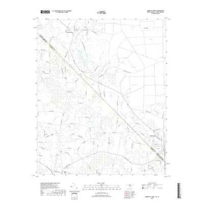
2019 Map of Tabor City West
USGS Topo · Published 2019About this map
Tabor City sits at the intersection of the North Carolina South Carolina border, serving as a focal point for the agricultural and wetland landscape of Columbus Co and Horry Co. This 2019 survey details the intricate drainage systems and swampy basins characteristic of the region, including the expansive Gapway Swamp and the distinct Tory Island landform within Big Bay. The map is particularly rich for genealogical research, documenting numerous family-named burial grounds like Coleman Cem, Godwin Cem, and Field Cem that are scattered across the rural landscape between Cherry Grove and Green Sea.
Find a feature on this map
118 named features on this map. Tap any name to fly to it.
Don’t see what you’re looking for? This feature index may not catch every label — zoom into the map to look around manually.
Map Details
Editions of this 2019 Tabor City West Map
This is the sole edition of this map. No revisions or reprints were ever made.
Other maps of this area

1943 · Pages Mill
USGS Topo · 1:62,500

1948 · Bayboro
USGS Topo · 1:24,000

1949 · Bayboro
USGS Topo · 1:24,000

1949 · Duford
USGS Topo · 1:24,000

1953 · Chadbourn
USGS Topo · 1:62,500

1953 · Florence
USGS Topo · 1:250,000

1954 · Florence
USGS Topo · 1:250,000
1962 · Loris
USGS Topo · 1:24,000

1962 · Fair Bluff
USGS Topo · 1:24,000
1962 · Goretown
USGS Topo · 1:24,000