Loading...
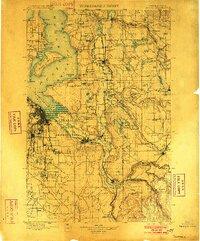
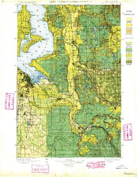
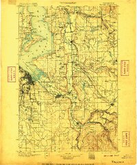
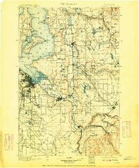
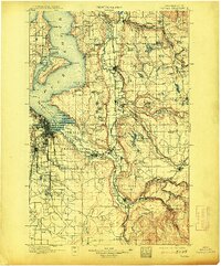
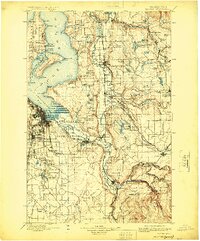
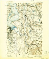
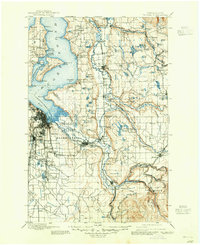
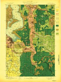
Loading map...1900 Map of Tacoma
USGS Topo · Published 1902About this map
Commencement Bay and the industrializing shoreline of Tacoma anchor this turn-of-the-century topographic record. The landscape is defined by the braided channels of the Puyallup River and White River, where early settlements like Puyallup and Auburn sit alongside the Puyallup Indian Reservation. Further south, the map captures the mining and timber hubs of Carbonado, Wilkeson, and Burnett, connected to the coast by the Northern Pacific Railway.
Find a feature on this map
145 named features on this map. Tap any name to fly to it.
Don’t see what you’re looking for? This feature index may not catch every label — zoom into the map to look around manually.
Map Details
Date Portrayed1900
Date Published1902
PublisherU.S. Geological Survey
Map TypeTopographic
Scale1:125,000
Physical Dimensions16.54 x 19.92 inches
Editions of this 1900 Tacoma Map
9 editions found

Historical Maps of Seattle Through Time
4 maps found


Featured Locations
Source Details
SourceU.S. Geological Survey
CopyrightPublic Domain