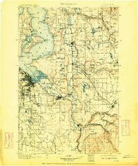
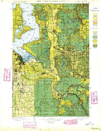
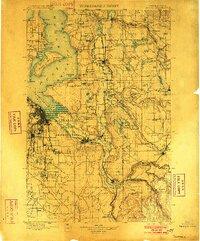
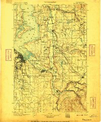
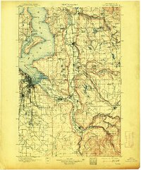
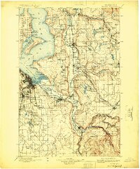
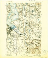
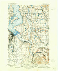
1900 Map of Tacoma
USGS Topo · Published 1909About this map
Puget Sound and the intricate shoreline of Admiralty Inlet anchor this turn-of-the-century topographic record, which documents a landscape transitioning from tribal lands and small coal settlements into an industrial rail corridor. The map highlights the extensive Puyallup Indian Reservation and Muckleshoot Indian Reservation, showing the early footprint of Tacoma alongside rural outposts like Chautauqua and Vashon Center on Vashon Island.
Find a feature on this map
130 named features on this map. Tap any name to fly to it.
Don’t see what you’re looking for? This feature index may not catch every label — zoom into the map to look around manually.
Map Details
Editions of this 1900 Tacoma Map
9 editions found
Other maps of this area

1894 · Seattle
USGS Topo · 1:62,500

1895 · Snohomish
USGS Topo · 1:125,000

1897 · Tacoma
USGS Topo · 1:125,000

1897 · Seattle
USGS Topo · 1:125,000

1900 · Tacoma
USGS Topo · 1:125,000

1908 · Seattle
USGS Topo · 1:62,500

1909 · Seattle Special
USGS Topo · 1:62,500

1913 · Cedar Lake
USGS Topo · 1:125,000

1916 · Chehalis
USGS Topo · 1:125,000

1921 · Sultan
USGS Topo · 1:125,000