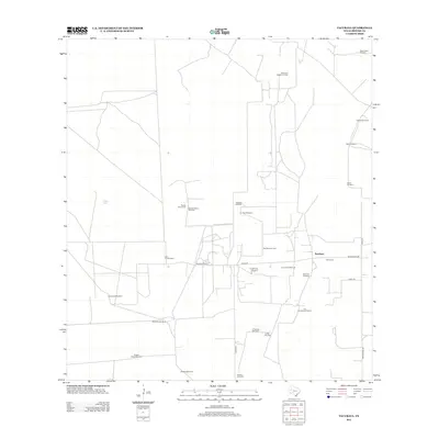
2012 Map of Tacubaya
USGS Topo · Published 2012About this map
Tacubaya and its surrounding ranchlands reveal a landscape shaped by water scarcity and energy extraction in southern Texas. The area is defined by a dense network of private windmills, such as the Mala Suerte Windmill and Novia Windmill, which are essential for sustaining livestock across these expansive parcels. Pockets of industrial activity are concentrated at the Scott and Hopper Oil Field and the Alta Mesa Oil Field, indicating the importance of petroleum to the local economy alongside traditional cattle ranching.
Find a feature on this map
32 named features on this map. Tap any name to fly to it.
Don’t see what you’re looking for? This feature index may not catch every label — zoom into the map to look around manually.
Map Details
Editions of this 2012 Tacubaya Map
This is the sole edition of this map. No revisions or reprints were ever made.
Other maps of this area

1921 · Falfurrias
USGS Topo · 1:125,000

1939 · Encantada
USGS Topo · 1:62,500

1949 · Mc Allen
USGS Topo · 1:250,000

1954 · McAllen
USGS Topo · 1:250,000

1956 · Laredo
USGS Topo · 1:250,000

1957 · Mc Allen
USGS Topo · 1:250,000

1962 · McAllen
USGS Topo · 1:250,000

1963 · Cage Ranch
USGS Topo · 1:24,000
1963 · Encino
USGS Topo · 1:24,000
1963 · Hartland
USGS Topo · 1:24,000