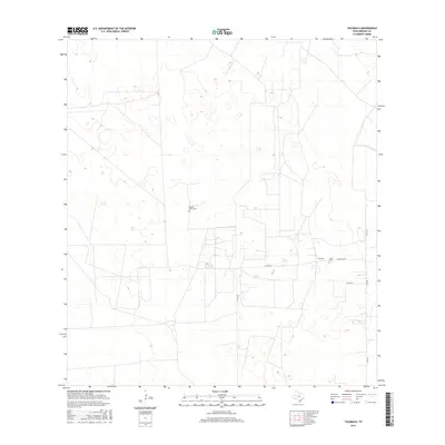
2016 Map of Tacubaya
USGS Topo · Published 2016About this map
The settlement of Tacubaya is situated in the brush country of Brooks County, where the landscape is defined by traditional ranching patterns and an arid network of water management features like Prieta Tank. This 2016 survey documents a rural Texas environment where local history is anchored by family-named landmarks and burial grounds. Genealogists and historians can identify the Rancho Nuevo Cem and Perez Cem, which serve as quiet markers of the area's long-standing ranching heritage. The map details the local infrastructure connecting these remote outposts, including FM 755 and Ranch RD 430, which traverse the flat plains and subtle depressions typical of the South Texas terrain. The grid of county roads, such as Co RD 314 and Co RD 315, illustrates the systematic division of land and the essential routes between isolated ranch headquarters and established roads.
Find a feature on this map
11 named features on this map. Tap any name to fly to it.
Don’t see what you’re looking for? This feature index may not catch every label — zoom into the map to look around manually.
Map Details
Editions of this 2016 Tacubaya Map
This is the sole edition of this map. No revisions or reprints were ever made.
Other maps of this area

1921 · Falfurrias
USGS Topo · 1:125,000

1939 · Encantada
USGS Topo · 1:62,500

1949 · Mc Allen
USGS Topo · 1:250,000

1954 · McAllen
USGS Topo · 1:250,000

1956 · Laredo
USGS Topo · 1:250,000

1957 · Mc Allen
USGS Topo · 1:250,000

1962 · McAllen
USGS Topo · 1:250,000

1963 · Cage Ranch
USGS Topo · 1:24,000
1963 · Encino
USGS Topo · 1:24,000
1963 · Hartland
USGS Topo · 1:24,000