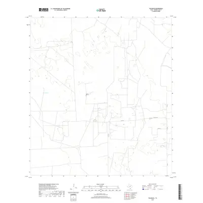
2019 Map of Tacubaya
USGS Topo · Published 2019About this map
Brooks County ranch lands are defined by large property divisions and essential water catchments in this South Texas landscape. Small family burial grounds like Rancho Nuevo Cem and Perez Cem provide critical genealogical evidence of the families who established these remote ranching outposts. The arid terrain is dotted with vital water features such as Prieta Tank, which serve as landmarks in an area of sparse settlement. Transport across the scrub and brush is facilitated by a network of rural routes, including Ranch Rd 430 and FM 755, connecting these isolated tracts to the wider region. The map reflects a modern era where traditional land use and cattle ranching persist as the primary economic and social drivers of the territory.
Find a feature on this map
11 named features on this map. Tap any name to fly to it.
Don’t see what you’re looking for? This feature index may not catch every label — zoom into the map to look around manually.
Map Details
Editions of this 2019 Tacubaya Map
This is the sole edition of this map. No revisions or reprints were ever made.
Other maps of this area

1921 · Falfurrias
USGS Topo · 1:125,000

1939 · Encantada
USGS Topo · 1:62,500

1949 · Mc Allen
USGS Topo · 1:250,000

1954 · McAllen
USGS Topo · 1:250,000

1956 · Laredo
USGS Topo · 1:250,000

1957 · Mc Allen
USGS Topo · 1:250,000

1962 · McAllen
USGS Topo · 1:250,000

1963 · Cage Ranch
USGS Topo · 1:24,000
1963 · Encino
USGS Topo · 1:24,000
1963 · Hartland
USGS Topo · 1:24,000