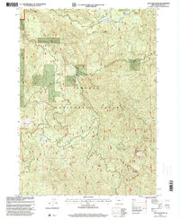
1997 Map of Taft Mountain
USGS Topo · Published 2000About this map
The Umpqua National Forest defines this high-elevation landscape in Douglas County, where the 1997 revision captures a wilderness of prominent peaks and forest infrastructure. The terrain is anchored by significant heights including Taft Mountain, Abes Mountain, and the descriptive Black Butte. Specialized forest features provide insight into the recreational and management history of the area, such as the Emile Shelter and the Peter Paul Shelter, alongside the notable Emile Big Tree landmark. Water drainage patterns are clearly marked by the Little River and its numerous tributaries like Emile Creek and Black Creek. The presence of a Quarry suggests localized resource extraction within the timberlands, while geographic oddities like Cool Water and the high-altitude Peter Paul Prairie highlight the varied ecological niches found across Clover Ridge.
Find a feature on this map
24 named features on this map. Tap any name to fly to it.
Don’t see what you’re looking for? This feature index may not catch every label — zoom into the map to look around manually.
Map Details
Editions of this 1997 Taft Mountain Map
This is the sole edition of this map. No revisions or reprints were ever made.
Other maps of this area

1955 · Quartz Mtn
USGS Topo · 1:62,500

1955 · Red Butte
USGS Topo · 1:62,500

1955 · Mace Mtn
USGS Topo · 1:62,500

1955 · Illahee Rock
USGS Topo · 1:62,500

1958 · Roseburg
USGS Topo · 1:250,000

1959 · Roseburg
USGS Topo · 1:250,000

1978 · Diamond Lake
USGS Topo · 1:100,000
1989 · Acker Rock
USGS Topo · 1:24,000
1989 · Taft Mountain
USGS Topo · 1:24,000
1989 · Old Fairview
USGS Topo · 1:24,000