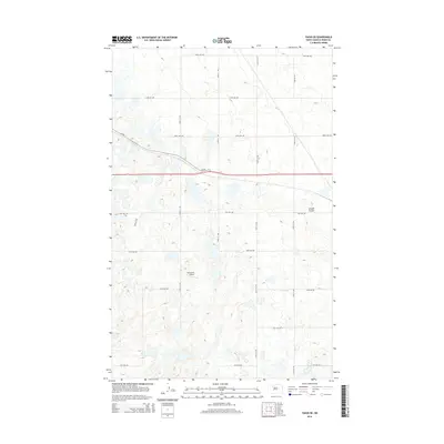
2014 Map of Tagus SE
USGS Topo · Published 2014About this map
Berg Strip Airport serves as a lone aviation landmark in this portion of Ward County, where the landscape is defined by an intricate network of township roads and section lines. The terrain is characterized by the numerous small glacial depressions and wetlands typical of the North Dakota plains, punctuated by the drainage of Arnold Coulee in the northeast. Transportation across the rural expanse relies on a grid of gravel routes including 128th Ave NW and 19th Ave NW, while CR-5w provides a diagonal artery through the central townships. This map captures the agricultural spatial organization of the early 21st century, showing how modern section-line roads continue to dictate the movement and settlement patterns of this prairie region.
Find a feature on this map
16 named features on this map. Tap any name to fly to it.
Don’t see what you’re looking for? This feature index may not catch every label — zoom into the map to look around manually.
Map Details
Editions of this 2014 Tagus SE Map
This is the sole edition of this map. No revisions or reprints were ever made.
Other maps of this area

1949 · Hartland
USGS Topo · 1:24,000

1949 · Carpio
USGS Topo · 1:24,000

1954 · Minot
USGS Topo · 1:250,000

1958 · Minot
USGS Topo · 1:250,000

1980 · Minot
USGS Topo · 1:100,000

1980 · Rice Lake NW
USGS Topo · 1:24,000

1980 · Tagus SE
USGS Topo · 1:24,000
1980 · Berthold
USGS Topo · 1:24,000
1980 · Aurelia
USGS Topo · 1:24,000

1980 · Tagus
USGS Topo · 1:24,000