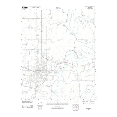
2010 Map of Tahlequah
USGS Topo · Published 2010About this map
The Illinois River winds through the eastern side of this landscape, carving through distinct terrain features such as River Bend Hollow and Steely Hollow, where a Waterfall is noted. As the capital of the Cherokee Nation, Tahlequah serves as the central hub of this quadrangle, shown here with its dense grid of streets and residential expansion near the Ross Branch and Tahlequah Creek. Local heritage is anchored by significant burial grounds including Grandview Cemetery, Tahlequah Cemetery, and the more remote Manus Cemetery.
Find a feature on this map
70 named features on this map. Tap any name to fly to it.
Don’t see what you’re looking for? This feature index may not catch every label — zoom into the map to look around manually.
Map Details
Editions of this 2010 Tahlequah Map
This is the sole edition of this map. No revisions or reprints were ever made.
Other maps of this area

1896 · Pryor
USGS Topo · 1:125,000

1898 · Tahlequah
USGS Topo · 1:125,000

1899 · Siloam Springs
USGS Topo · 1:125,000

1901 · Muscogee
USGS Topo · 1:125,000

1901 · Pryor
USGS Topo · 1:125,000

1901 · Tahlequah
USGS Topo · 1:125,000

1903 · Siloam Springs
USGS Topo · 1:125,000

1904 · Siloam Springs
USGS Topo · 1:125,000

1905 · Muscogee
USGS Topo · 1:125,000

1905 · Tahlequah
USGS Topo · 1:125,000