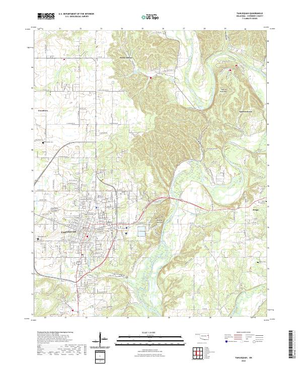
2022 Map of Tahlequah
USGS Topo · Published 2022About this map
Tahlequah serves as the focal point of this Oklahoma landscape, where the confluence of academic life at Northeastern State University and local governance at the Cherokee County Courthouse defines the town's character. The surrounding terrain is deeply carved by the Illinois River and its tributaries like Tahlequah Cr and Pecan Cr, creating a complex network of hollows such as Steely Hollow and River Bend Hollow. The topography rises sharply toward the east, marked by Sparrow Hawk Mtn and the unique McSpadden Falls near the river's edge.
Find a feature on this map
174 named features on this map. Tap any name to fly to it.
Don’t see what you’re looking for? This feature index may not catch every label — zoom into the map to look around manually.
Map Details
Editions of this 2022 Tahlequah Map
This is the sole edition of this map. No revisions or reprints were ever made.
Other maps of this area

1896 · Pryor
USGS Topo · 1:125,000

1898 · Tahlequah
USGS Topo · 1:125,000

1899 · Siloam Springs
USGS Topo · 1:125,000

1901 · Muscogee
USGS Topo · 1:125,000

1901 · Pryor
USGS Topo · 1:125,000

1901 · Tahlequah
USGS Topo · 1:125,000

1903 · Siloam Springs
USGS Topo · 1:125,000

1904 · Siloam Springs
USGS Topo · 1:125,000

1905 · Muscogee
USGS Topo · 1:125,000

1905 · Tahlequah
USGS Topo · 1:125,000