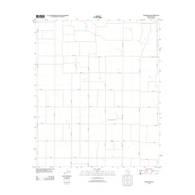
2012 Map of Tahoka SW
USGS Topo · Published 2012About this map
Wells anchors the southern portion of this West Texas landscape, situated along the intersection of Fm-213 and Ranch Rd 3112. The terrain is defined by a dense, systematic grid of agricultural access roads, including Edward Rd and numerous numbered county routes such as Co Rd-321 and Co Rd-331. This organized layout reflects the intensive land use and boundary management common in Lynn County during the early 21st century. Aside from the small cluster at Wells, the map reveals a quiet rural character marked by the private L P Askew Farms Airport, suggesting a reliance on local aviation for large-scale ranching or farming operations. The network of county roads connects the dispersed farmsteads that define the regional economy and social geography.
Find a feature on this map
19 named features on this map. Tap any name to fly to it.
Don’t see what you’re looking for? This feature index may not catch every label — zoom into the map to look around manually.
Map Details
Editions of this 2012 Tahoka SW Map
This is the sole edition of this map. No revisions or reprints were ever made.
Other maps of this area

1954 · Lubbock
USGS Topo · 1:250,000

1954 · Hobbs
USGS Topo · 1:250,000

1954 · Big Spring
USGS Topo · 1:250,000

1954 · Brownfield
USGS Topo · 1:250,000

1958 · Brownfield
USGS Topo · 1:250,000

1958 · Big Spring
USGS Topo · 1:250,000

1958 · Hobbs
USGS Topo · 1:250,000

1962 · Brownfield
USGS Topo · 1:250,000

1969 · Welch East
USGS Topo · 1:24,000

1969 · Mound Lake
USGS Topo · 1:24,000